Shp
Advertisement
CtrlCAD source code C++ v.11.4.0.0
CtrlCAD is a 2D source code cad. It is the starting point to build your own customized drawing applications (CAD/GIS). The library is furnished in source code formats.Royalties free.
Advertisement
CAD2Shape v.6.0
CAD2Shape converts AutoCAD DXF/DWG drawing files to ESRI shapefile format. It can translate holes / islands /donuts from originating CAD drawing to Polygon shapefile. It can translate 3D surfaces to MultiPatch shapefile types.
VaryView v.1.4.0002
VaryView is a handy image viewer / converter for picture, photo, fax and CAD files created in popular raster and vector graphics formats.
GeoVisu v.5.0.1
GeoVisu is a program that displays georeferenced data (images, graphics) and downloads data recorded by some GPS devices. GeoVisu has a 'Moving map' navigation function, which can be used with any NMEA 0183 compatible or Garmin USB GPS device.
Avax-CAD v.1.0.0014
Avax-CAD is a stand alone 2-dimension (21/2D) drawing program, which addresses Architects, Civil Engineers, Electrician Engineers, Mechanical Engineers, Topographers, Designers, Students and generally everyone who is occupied with geometrical drawing
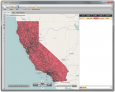
AgDataViewer v.5 5
ADV comes with tools that allow you to create polygons, lines and points in fields from the comfort of your office.
Speleoliti v.3.0
Speleoliti is a powerful and user-friendly software for spatial modelling. It is especially designed for speleological needs (cave mapping software), but also suitable for other kind of geo-works.
RW Net pro v.2 20
RW Net pro is an easy to use software tool for developers who need to create routing enabled applications and power users with a need for doing complex network analysis.
GPS Pathfinder Office v.5 20
Powerful and easy to use GPS data processing software The GPS Pathfinder Office software is a powerful and easy-to-use software package of powerful GNSS postprocessing tools, incorporating the new Trimble DeltaPhase differential correction techno
KML2KML v.3.0.12
KML2KML is an application including tools for reorganization and optimization of your kml/kmz data.
Manco Shapefile Editor v.1.0.0.0
Manco Shapefile Editor is a powerful tool for creating and editing shapefiles, with easy, almost ?on the fly?, geometry and data editing and possibility of direct creation of the shapefiles from the image files by image processing algorithms.