Shp
Advertisement
AnyChart Flash Map Converter v.1.0.4
Convert ESRI ShapeFiles (.SHP) geolocation data into AnyMap format to be used with AnyChart. AnyChart Flash Map Converter allows making use of a wide choice of maps with AnyChart, a GIS system that recognizes map data in AnyMap format only.
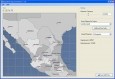
Avangardo ShapeView v.2.4
Avangardo ShapeView is an ESRI shape files and MapInfo interchange files viewer. Using this utility you can view *.SHP files (ESRI shape files). No *.DBF and *.DBX files are needed. Only polygonal and linear features are supported. Points will not be
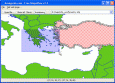
ShapeView v.2.3
It is a FREE ESRI shape files (*.shp), MapInfo interchange (*.mif) and *.dxf files viewer. Using this utility you can view *.shp files (ESRI shape files) and *.mif files (MapInfo interchange). No other files are needed. Source codes are available.
ShapeViewer v.1 2
Shape Viewer is a free tool, which you can use to view ESRI Shape files. Shape Viewer can open (.shp) files that contain the geometry information of the shape file.With Shape Viewer you can also create new (.shx) file, and new empty (.
ECITATION® v.4.0.2
eCITATION is a cooperative effort with the NC Criminal Justice Information Network (CJIN), the NC State Highway Patrol (SHP) and the NC Administrative Office of the Courts (NCAOC) that automates the transfer of citation data directly from a law enfor
AnyChart Map Converter v.1.0.3261.26913
Visualize geolocation data in ESRI ShapeFiles format. AnyChart Map Converter utility is designed to convert ESRI ShapeFiles (*.shp) into the special AMAP format for using in the geo map module of AnyChart Flash Component - AnyMap.
CircleDB for CircleMud v.b.0.01
CircleDB is an sql database with a php frontend that can import, manipulate, and export CircleMud World database files (wld,shp,obj,mob,zon).
GeoVisu v.5.0.1
GeoVisu is a program that displays georeferenced data (images, graphics) and downloads data recorded by some GPS devices. GeoVisu has a 'Moving map' navigation function, which can be used with any NMEA 0183 compatible or Garmin USB GPS device.
Speleoliti v.3.0
Speleoliti is a powerful and user-friendly software for spatial modelling. It is especially designed for speleological needs (cave mapping software), but also suitable for other kind of geo-works.
GPS Pathfinder Office v.5 20
Powerful and easy to use GPS data processing software The GPS Pathfinder Office software is a powerful and easy-to-use software package of powerful GNSS postprocessing tools, incorporating the new Trimble DeltaPhase differential correction techno